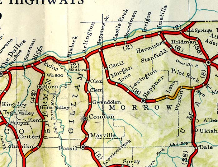
 Section image (enlarge image).
IRRIGON,
8 m. (297 alt., 65 pop.), on the site of old Grande Ronde Landing, a former stopping place for travelers, derives its name and sustenance from the irrigation district of which it is the center. An experiment farm nearby demonstrates the agricultural possibilities of the rich soil.
At 11.2 m. is a junction with a side road.
Right on this road to PATTERSON FERRY, 1 m. (toll for cars and five persons, $1; round trip, $1.50) connecting with US 410 at Prosser, Washington.
On a slight knoll (R) at 19.7 m. is a mounted specimen of Indian picture writing. The engraved boulder was found on the bank of the Columbia River a few miles east of its present location.
BOARDMAN, 19.8 m. (250 alt., 100 pop.), lies in an area that holds the fossilized remains of prehistoric animals. Specimens include part of a mastodon tooth, bones of fishes, of the three toed horse, of the rhinoceros, and bits of turtle shell.
Left from Boardman on the Boardman Cut off across a barren stretch of sagebrush plains to an unimproved road at 15 m.
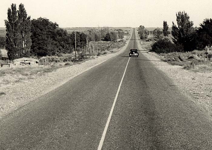 The highway near Boardman (2204). Enlarge image.
Left 1 m. on the dirt road, dusty and deeply rutted as it was in the days of the wagon trains, to WELLS SPRINGS and the WELLS SPRINGS CEMETERY. The cemetery (L) is identified by its high, rabbit tight fence. Here were buried several pioneers, also Colonel Cornelius Gilliam who on March 24, 1849, was killed by the accidental discharge of his gun.
West of Boardman US 30 follows the river, a green band separating bleak and barren shores.
CASTLE ROCK, 25.6 m. (241 alt., 10 pop.), once a busy community, now is a station on the railroad edging an empty plain. The magazine West Shore for October, 1883, records: "Castle Rock ... now contains an express office, post office, saloons, dwellings, schools, etc ... The growth of western towns is wonderful."
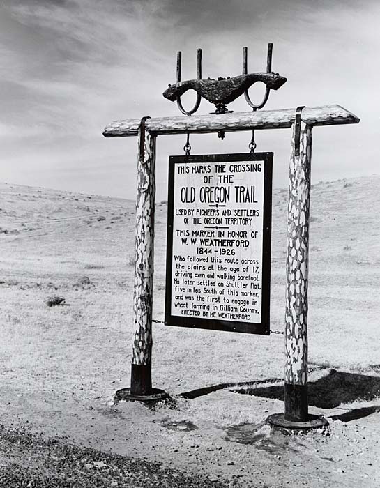 Old Oregon Trail marker on Arlington-Condon highway (1007). Enlarge image.
HEPPNER JUNCTION,
35.1 m. (241 alt.), distinguished by an airplane beacon on the cliff (L), is the junction of the Union Pacific Railroad main line with its Heppner branch, as well as the junction of US 30 with State 74.
Left from Heppner junction on State 74 through a narrow rimrock walled cleft up Willow Creek. Rust colored, basaltic cliffs are in vivid contrast with emerald green alfalfa fields, sub irrigated by gravity flow of water from Willow and its tributary creeks, and from underground springs. As the route continues into the gradually rising country, wheat fields roll away to the bench lands on either side of the highway.
During gold rush days, miners traveling from lower Columbia River points to the Idaho and John Day mining districts, passed through Willow Creek Valley, hastening south by way of Dixie Creek and the forks of the John Day River. Processions of Columbia River Indians followed this road, to hunt deer, pick berries, and camp in the Blue Mountains, returning down the creek for the salmon fishing at Celilo.
At 15.1 m. is a junction with a gravel road; L here 0.5 m. to CECIL (618 alt., 15 pop.), by the Oregon Trail crossing of Willow Creek. The settlement was an important stage station. The WELL, where travelers obtained drinking water for themselves and their teams, remains at the center of the village street.
On State 74 is MORGAN, 20.4 m. (10 pop.), in early days called Saddle. The stage station of the name was situated, until 1888, on a side road about 2 m. northwest of the present site. SADDLE BUTTE is right.
 Arlington (947). Enlarge image.
IONE, 29 m. (1,090 alt., 283 pop.), is strategically situated near the mouth of Rhea Creek, and is also at the junction of the Boardman Cut off Highway (L). During the late 19th and early 20th centuries, lone was considered an ideal picnic site for conventions, celebrations and pioneer gatherings.
At 32.7 m. is a gravel road; R. here 6 m. to the OREGON CREAM-O-LINE RANCH, the only palomino horse ranch in the Pacific Northwest. Palominos are golden and cream, or ivory colored horses, a gentle and tractable product of fine breeding, that are used for show purposes and racing.
LEXINGTON, 37.7 m. (1,418 alt., 180 pop.), a shipping center for wheat, is at a junction with State 207.
West of Heppner junction, US 30 crowds close upon the river, in places climbing along the basaltic cliffs, affording views of the gorge and the piling mountains to the north in Washington.
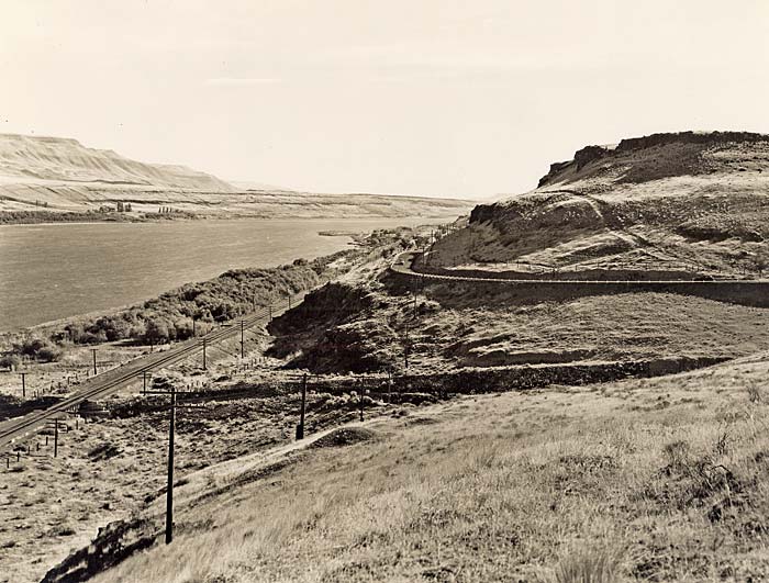 Lang Canyon looking east on Columbia River Highway (956). Enlarge image.
ARLINGTON,
46.5 m. (224 alt., 601 pop), first known as Alkali, was given its present name by N. A. Cornish in commemoration of the home of Robert E. Lee. The first dwelling was erected on the site in 1880 by Elijah Rhea, and the town of Alkali was platted two years later by J. W. Smith. The town was incorporated in 1887. Ducks and geese are plentiful in the vicinity; the open season is from October 21 to November 19, inclusive. Hunting rights are often rented from the ranchers at $8 to $10 a day. The Arlington Ferry (cars, $1 ; round trip, $1.50) makes connections with Roosevelt, Wash. At Arlington is a junction with State 19.
Passing through BLALOCK, 55.4 m. (216 alt., 16 pop.), US 30 threads the narrow gorge through which the Columbia has cut its channel. From SQUALLY HOOK at 70.1 m., Mount Hood is seen to the southwest, rising above the waters of the Columbia River.
The JOHN DAY RIVER, 70.5 m., called LePage's River by Lewis and Clark for a member of their party, honors a member of the Astorians. Washington Irving describes John Day as "a hunter from the backwoods of Virginia ... about forty years of age, six feet two inches high, straight as an Indian; with an elastic step as if he trod on springs, and a handsome, open, manly countenance. He was strong of hand, bold of heart, a prime woodsman, and an almost unerring shot." Day, with Crooks and several French Canadians, fell behind on the Snake River, while Hunt forged ahead with the main party in the winter of 1811-12. The following spring when, after many hardships, the two Americans reached the mouth of the John Day River "they met with some of the 'chivalry' of that noted pass, who received them in a friendly way, and set food before them; but, while they were satisfying their hunger, perfidiously seized their rifles. They then stripped them naked and drove them off, refusing the entreaties of Mr. Crooks for a flint and steel of which they had robbed him; and threatening his life if he did not instantly depart." In this forlorn plight they were found months later by a search party and taken to Astoria. Day decided to return to the States with Robert Stuart's party, but before reaching the Willamette became violently insane and was sent back to Astoria where he died within the year.
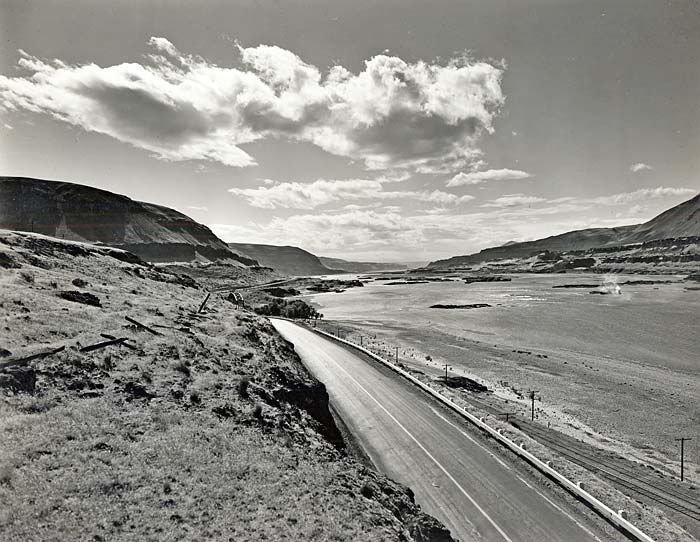 The Columbia River near mouth of John Day River (156). Enlarge image.
In the striated gorges carved by the swift waters of the John Day River are written the successive chapters of Oregon's geological evolution.
Across the river from RUFUS, 75.5 m. (180 alt., 70 pop.), stands the STONEHENGE MEMORIAL to the World War dead, a reproduction of the ruin in England. It was built by Samuel Hill.
At 78.1 m. is a junction with US 97.
Right on US 97 to the Maryhill ferry, 0.4 m. (fare $1; service as needed). From the north bank ferry landing in Washington, US 97 continues to the junction with US 830, 1.2 m.; L. here 2.9 m. on US 830 to MARYHILL CASTLE, also built by Samuel Hill. It is a three story rectangular structure of concrete, set on a bluff 800 feet above the river. Though the building was dedicated by Queen Marie of Romania in 1926, it was not opened to visitors until 1937. Queen Marie gave the museum a life size portrait of her daughter, a desk, chairs, and other pieces of furniture. Hill lavished a fortune on the estate but never made it his home. However, he left a bequest of $1,200,000 for completing and maintaining it as a museum. In a crypt repose the owner's ashes, commemorated by a tablet bearing the inscription: "Samuel Hill amid Nature's unrest, he sought rest."