SEASIDE, 20.4 m. (16 alt., 1,565 pop.), (hotels, tourist cottages; seawater natatorium), Oregon's largest seaside resort, spreads across the narrow Necanicum River, which parallels the coast, and up and down a long narrow sandy bar. On the ocean side of this bar is a seawall that also forms a "boardwalk" above the beach. At the southern end of town the ground rises abruptly into a wooded ridge that bulges westward and forms a high, bold promontory.
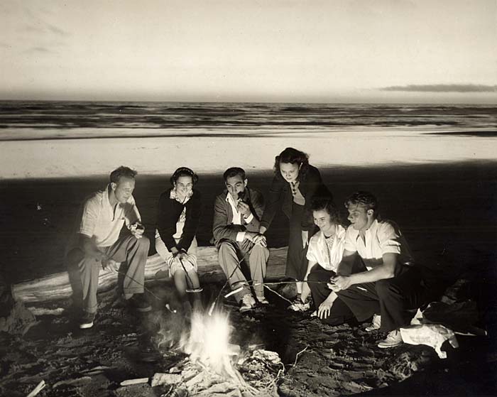
 Seaside beach fire (G538). Enlarge image.
Seaside was developed in the 1870s by Ben Holladay, already famed as former operator of the Overland Stage when he became a railroad builder in Oregon. Holladay built the sumptuous Seaside House, which attracted prominent guests from far and wide. Some came down the Columbia to a landing point on the Skipanon River, near Astoria, where they were met by beautifully equipped stage coaches for the last leg of the journey. Others came from San Francisco via Holladay steamers.
On the promenade at the foot of Main Street is the END OF THE TRAIL MONUMENT, commemorating the Lewis and Clark journey. Near the southern end of the promenade on Q Street are the ruins of the SALT CAIRN, a heap of brine-crusted rocks protected by an iron railing. It was built by the men Lewis and Clark sent to get salt by boiling down sea water. Clark wrote that he "Derected...Jos. Fields, Bratten, Gibson to proceed to the Ocean at Some Convenient place form a Camp and Commence makeing Salt with 5 of the largest Kittles, and Willard and Wiser to assist them in Carrying the Kittles to the Sea Coast...." Willard and Wiser later reported that the men "had at length established themselves on the coast about 15 Miles S. W. from this, near the lodge of some Killamuck families; that the Indians were very friendly and had given them a considerable quantity of the blubber of a whale which perished on the coast some distance S.E. of them; part of this blubber they brought with them, it was white & not unlike the fat of Poark, tho' the texture was more spongey and somewhat courser." Lewis had some of the blubber cooked and liked it. According to Lewis,
"... they commenced the making salt and found that they could obtain from 3 quarts to a gallon a day; they brought with them a specemine of the salt of about a gallon ... this was a great treat to myself and most of the party, having not had any since the 20th ultmo.; I say most of the party, for my friend Capt. Clark declares it to be a mear matter of indifference with him whether he uses it or not; for myself I must confess I felt a considerable inconvenience from the want of it; the want of bread I consider as trivial provided, I get fat meat, for as to the species of meat I am not very particular, the flesh of the dog the horse and the wolf, having from habit become equally formiliar with any other, and I have learned to think that if the chord be sufficiently strong, which binds the soul and boddy together, it dose not so much matter about the materials which compose it."
 Seaside End of the Trail Monument (G215). Enlarge image.
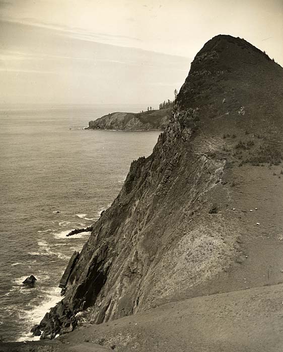
Right (straight ahead) from the south end of First Street on a trail (rocky for about a mile) that swings south following an old logging road and climbs up the ridge that terminates near TILLAMOOK HEAD (1,260 alt.),
4 m. Along the ridge are sweeping views of the territory northward. From the Head, TILLAMOOK LIGHTHOUSE is seen offshore, rising 41 feet on an isolated rock so sheer that people visiting the lighthouse frequently have to be landed in a breeches buoy. The base of the lighthouse is 91 feet above the water. Winter gales sweep this rock with hurricane force and the lighthouse keeper is frequently isolated for long periods. This lighthouse is described in John Fleming Wilson's sea stories. Far below the crest of Tillamook Head, gulls wheel above the waves that swirl in DEATH TRAP COVE.
South of Seaside U.S. 101 follows the NECANICUM RIVER, 23.3 m., through green lowlands, bordered with alders and willows and yellow-patched in spring with huge skunk cabbages, whose leaves were used by the Coast Indians to wrap food in cooking pits. Lettuce and peas are the principal crops grown on farms in this district.
At CANNON BEACH JUNCTION, 24.1 m., is the junction with a road paved with asphalt.
Right on this road, winding through groves of gigantic hemlock to CANNON BEACH, 5 m. (25 alt., 125 pop.), an ocean resort so named because a cannon was washed ashore here from the American ship "Shark," wrecked in 1846 at the mouth of the Columbia River. She had been sent to the coast during the turbulent discussions that ended with the annexation of the Oregon Country by the United States. The cannon stands beside the foot trail that leads south along the coast. Just offshore is HAYSTACK ROCK (300 alt.).
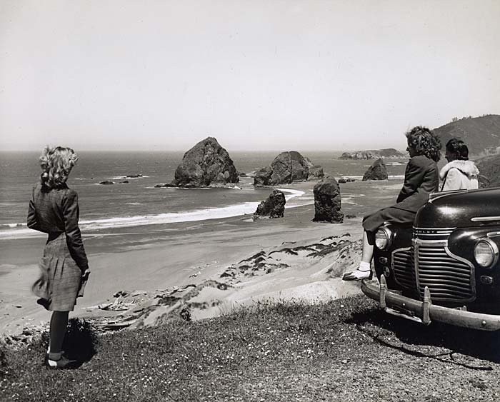
 Cannon Beach horses and pinnacles (1237). Enlarge image.
The road continues south tunneling ARCH CAPE,
11.4 m. It has been carved into a bluff at Neahkahnie Mountain, 500 feet above the sea. Neahkahnie, one of the many places along the coast south of this point with names beginning with the Indian prefix "ne" (which related to villages or places), was known to the Tillamooks as the place of the fire god. Neahkahnie Mountain (1,638 alt.), has been the setting for several books, among them being "Beeswax and Gold" by Thomas Rogers; "Ward of the Redskins" by Sheba Hargreaves; and "Slave Wives of Nehalem" by Claire Warner Churchill.
At 18.8 m. is the junction with an improved road. Right here 0.3 m. to MANZANITA (150 pop.), both a beach and mountain resort. A collection of relics here is associated with the Neahkahnie treasure story. It was on the beach near this point that the whale reported by William Clark was washed ashore. The town is in a cove protected by the rugged headlands to the north.
The main road turns inland to NEHALEM, 21.1 m. (16 alt., 245 pop.), and crosses the Nehalem River to a junction with U.S. 101, 22.2 m., near Wheeler.
From Cannon Beach Junction, U.S. 101 veers inland several miles into the Necanicum (Ind., place of lodge) Valley, where herds of elk, protected by law, have been placed. The NECANICUM STATE FISH HATCHERY, 31.3 m., annually releases millions of trout fingerlings in coast streams.
In its loop inland, the highway skirts the rugged area over which William Clark struggled with a small party that was eager to see the whale that had been cast ashore (see above). At her personal request, Sacajawea was with the men on this journey.
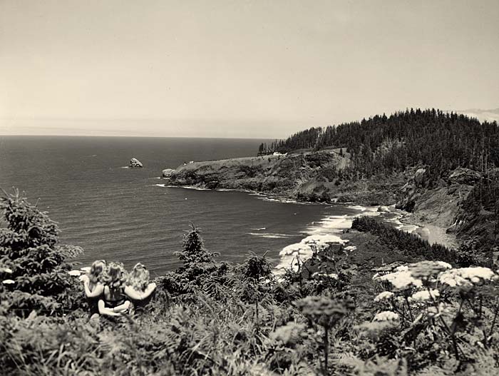
 Neah-Kah-Nie Mountain vista from state park (G228). Enlarge image.
NECANICUM JUNCTION, 33.5 m., is a junction with State 2, the super highway between Portland and the sea.
U.S. 101 crosses the North Fork of the Nehalem River, 41.3 m., which it follows downstream.
Sharp downward slopes, now denuded of spruce, cedar, and hemlock, indicate the site of former high-line logging, characterized by the network of cables, blocks, and guy lines strung from spars (trees denuded of limbs), along which logs are pulled by donkey engines from one ridge to the other. High-climbers, whose insurance rates indicate the great risks of their calling, trim and top 200-foot trees, which they climb with the aid of spurs and a rope loop attached to a belt. In the timber a chokerman places a heavy wire slip-loop, or choker, around a log. A rigging-slinger attaches this loop to the main cable, when the hooker yells "Hi," then the whistle-punk presses an electric grip and the donkey 1,500 feet away whistles a short, sharp blast. The donkey-puncher, or engine operator, "opens her up" and the log rises above stumps and brush as he yards it to the landing. As soon as the chaser has unhooked the log, a haulback returns the choker to the woods.
U.S. 101 crosses the Nehalem River to MOHLER, 51.6 m. (27 alt., 50 pop.), which has a cooperative cheese factory (L.) that, like others in the region, is identified by its yellow paint. Many people of Swiss birth or descent operate dairies in the vicinity. They are particularly fond of playing the accordion and yodeling during their leisure hours.
At 52.6 m. is the junction with the Cannon Beach Road.
At WHEELER, 53.5 m. (48 alt., 280 pop.), by Nehalem Bay, the shrill scream of shingle-mill saws and odor of fresh cedar is as characteristic of the town as is the cry of the gulls that soar above the three fish-packing houses along the waterfront.
 Beach at San Sebastian (2501). Enlarge image.
Immediately west of Wheeler is HOEVET, 54.3 m., (200 pop.), named for C.R. Hoevet, manager of a local lumber mill. The Hoevet post office functions within a few blocks of the Wheeler post office.
LAKE LYTLE (L.), 60.5 m. (15 alt.), a brackish, shallow body of water, is a state bird refuge. Many species of aquatic birds nest and feed along its reedy shores. Occasionally a man is seen behind a blind snaring ducks and geese for a state game farm, where they are used for study and propagation.
ROCKAWAY, 61.1 m. (15 alt., 300 pop.), is another attractive resort (sea water natatorium), with a wide beach. Offshore are the arched TWIN ROCKS.
From the north, BARVIEW, 64.4 m. (16 alt., 60 pop.), overlooks the narrow entrance to Tillamook Bay, named for the Indians who lived in the district. In 1788 Capt. Robert Gray crossed the bar and anchored his ship "Lady Washington" inside the bay. For a time, the crew traded peaceably with local Indians and gathered supplies ashore. But in his log, Robert Haswell described why the place came to be called "Murderer's Harbor." Marcus Lopius, a black member of the crew, when endeavoring to recover a cutlass that had been stolen by an Indian, was killed. Other crew members tried to rescue him, but as Haswell wrote in the log: "...the first thing which presented itself to our view was a very large groop of the natives among the midst of which was the poor black with the thief by the colour loudly calling for assistance saying he had cought the thief, when we were observed by the main boddy of the Natives to haistily aproach them they instantly drenched their knives and spears with savage feury in the boddy of the unfortunate youth. He quited his hold and stumbled but rose again and stagered towards us but having a flight of arrows thrown into his back and he fell within fifteen yards of me and instantly expiered while they mangled his lifeless corse."
Early the next morning, Gray put to sea.
 Oceanside overlooking Cape Meares (715). Enlarge image.
South of the bay is CAPE MEARES (700 alt.), with its lighthouse. The view of the cape is sometimes obscured by mist or spray. The headland was named for Capt. John Meares, English explorer.
The route swings inland to skirt the shores of the bay and passes the TILLAMOOK BAY COAST GUARD STATION, 64.2 m.
GARIBALDI, 66 m. (10 alt., 213 pop.), facing the bay, was formerly an important mill town. The dikes along the Miami River, 67.4 m., as well as those along other rivers in cheese-making Tillamook County, earned the district the name of Little Holland. Grazing in meadows yellow with buttercups are the cows that produce milk for the cheese kitchens, where cream cheese is made and placed in long rows of shelves in the cooling rooms to mellow.
On HOBSONVILLE POINT (R.), 68.4 m., overgrown with alders, once stood the lively lumber town of Hobsonville. An empty hotel and several bleached frame dwellings remain. The mill ruins were recently washed into the bay.
BAY CITY, 70.5 m. (17 alt., 427 pop.), possibly named for Bay City, Michigan. During a salmon run in Tillamook Bay, the catches of the night fishing fleets are dressed and stored in local canneries (admittance by arrangement at offices).
The 18-hole public ALDERBROOK GOLF COURSE (small fee), 72.6 m., has an excellent club house.
A section of the highway just west of the Kilchis River Bridge, 74 m., is frequently inundated during winter rains. It is said during these floods some motorists find salmon on their running boards.