PORT ORFORD, 165.6 m. (56 alt., 300 pop.) took its name because of its proximity to Cape Blanco, which Capt. George Vancouver called Cape Orford in honor of his friend, the Earl of Orford. This rambling village on a bluff has wide view of the Pacific.
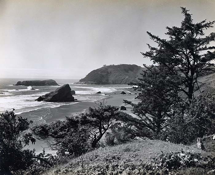
 Coast highway looking north toward Cape San Sebastian (370). Enlarge image.
Near the village is BATTLE ROCK where nine men were landed in June 1851 with supplies, arms and ammunition by Capt. William Tichenor of the "Sea Gull." The men battled with Indians shortly after landing and again two weeks later. Vastly outnumbered, they fled to the mouth of the Umpqua River, where they were welcomed by whites living in the area. The following month, Capt. Tichenor returned with a much larger party, which established a camp at Port Orford. According to Tichenor, "two block houses were erected inside of heavy logs and everything done for a permanent settlement."
After Curry County was created in 1855, the Territorial Legislature placed the county seat temporarily at Port Orford. The first county courthouse was in the home of local resident Frederick Smith.
At the southern limits of Port Orford stands (R.) the KNAPP HOTEL, a plain white weathered building. Louis Knapp, who died in 1929, extended his hospitality here, and in previous structures, for generations.
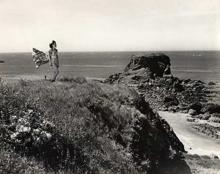
 Cape San Sebastian and beach looking north from highway (2153). Enlarge image.
Rooms in the hotel are designated by names of illustrious persons. There is a Sherman Room, an Ellen Tichenor Room, a Joe Meek Room, a Jack London Room, and a W.H. Seward Room. The story is told that Seward, by then a former Secretary of State, was a guest of Mr. Knapp on his way to visit Alaska, whose purchase he helped negotiate.
Port Orford was the home of Minnie Myrtle Dyer, poet of the I860s and '70s, when she married Joaquin Miller, who had admired her printed works and started a correspondence that led to Miller's visit here. After three days, they were married and started off on horseback to Eugene. The marriage lasted only eight years, and Mrs. Miller took revenge by lecturing caustically on her former husband.
The name Port Orford is associated with a sizable meteorite, supposedly discovered in 1856 by Dr. John Evans, some 30 to 35 miles from the southwest Oregon coast. Although Evans provided general directions to the site, no one has found it in the years since.
 Harris State Park near Brookings (1169). Enlarge image.
South of Port Orford the mountains press close to the sea and the highway curves along a shelf high above the waves. HUMBUG MOUNTAIN STATE PARK, 169.9 m., includes HUMBUG MOUNTAIN (1,748 alt.). The massive promontory was formerly called Sugar Loaf Mountain, then Tichenor's Humbug. According to Capt. Tichenor, the latter name came from members of an exploratory party who disregarded his directions for ascending the south side of the mountain. They became lost, said Tichenor, and assigned the new name "to palliate their gross failure."
Green-walled BRUSH CREEK CANYON, 173.1 m., is the deepest gorge crossed on this section of the coast highway.
At 182 m. is the SITE OF FRANKFORT, a former village with a shipping dock on SISTERS ROCKS, just offshore, reached from the mainland by a bridge and wooden railway.
The name of EUCHRE CREEK, 185 m., likely derived from a band of Tututni Indians called Yukichetunne. The band's name meant "people at the mouth of the river." South of the creek are sandy hills bright in season with yellow sand verbena and vivid lupine.
 Harris State Park near Brookings (1168). Enlarge image.
At 190 m. is the junction with an improved dirt road.
Right here to GEISEL MONUMENT STATE PARK, 0.5 m., a memorial to the family of John Geisel who with his three sons was slain by Indians in 1856, during the Rogue River Indian wars. The mother and two daughters were captured but later released.
WEDDERBURN, 196 m. (24 alt., 100 pop.), on the north bank of the Rogue River, is a vacation resort with a small myrtle wood factory and small hotel. For years it had a salmon cannery, but it was shut down because of the closing of the Rogue to commercial fishermen. The Rogue is famous for steelhead and salmon fishing. Small boats are able to ascend the river about 32 miles. The route crosses the Rogue River on the long, arched concrete ISAAC L. PATTERSON BRIDGE, named for a former Oregon governor.
GOLD BEACH, 197.1 m. (71 alt., 500 pop.). Seat of the most primitive county in Oregon, Gold Beach has only begun to shed its pioneer appearance. The town takes its name from the mining on Curry County beaches, beginning in the early 1850s. Small operations for gold and platinum are still carried on upstream, and mining sometimes muddies the current to such an extent that its brown waters are seen far offshore.
At 204.6 m. is the junction with an improved road.
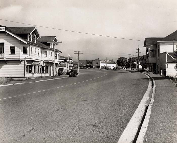
 North entrance to Brookings (1920). Enlarge image.
Right here to high CAPE SEBASTIAN, 1 m., which juts into the ocean to form one of the striking landmarks of the southern coast, rising 700 feet sheer above the water. Roads and trails lead to view points commanding splendid views of the Pacific. In 1603, on an exploring expedition, Sebastian Vizcaino spotted a white bluff near what he thought was the 42nd parallel and named it San Sebastian in honor of the saint of that day. What bluff Vizcaino actually saw is not clear, but Cape Sebastian takes its name from that event.
From this point is visible (R) CAPE FERRELO (not accessible from the highway), named for Bartolome Ferrelo, who may have sailed as far north as the Oregon coast in 1543.
Making sweeping curves, sometimes along ledges of gold-bearing quartz and through heavy timber, the route passes a huge KITCHEN MIDDEN (R) 208.7 m., and descends to PISTOL RIVER, 210.7 m. The name commemorates James Mace's loss of a firearm in the stream in 1853. According to an 1854 report from Indian agent J.L. Parrish, the river also bore the name of the Chetl-essentan Indians, who had a village near its mouth. In March 1856, during the Rogue River wars, a company of volunteer troops was caught offguard and placed on the defensive by Indians at Pistol River. The volunteers held out, with a loss of one man, until their eventual rescue by regular troops.
CARPENTERVILLE, 218.5 m. (1,715 alt., 35 pop.), is the highest point on the highway. Mount Shasta is seen (L.) on clear days. Ghost forests, where fires have blackened the trees, mark the approach to HARRIS STATE PARK, 232.3 m., which overlooks a narrow beach and bird rookeries offshore.
BROOKINGS, 234.2 m. (129 alt., 250 pop.), by Chetco Cove, grew up around a large sawmill.
U.S. 101 crosses Winchuck River (Ind., Windy River), 239.9 m., and at 240.4 m. crosses the California Line 21 miles north of Crescent City, CA.