 Section map (enlarge image).
West of La Grande US 30 winds up the gorge of the Grande Ronde River into the Blue Mountains, Oregon's oldest land, known to geologists as the Island of Shoshone. The Blue Mountains were one of the most formidable barriers in the path of the pioneer. In 1839 Thomas Farnham wrote about "The trail ... over a series of mountains swelling one above the other in long and gentle ascents covered with noble forests of yellow pine, fir and hemlock." In the evening "the mountains hid the lower sky, and walled out the lower world. We looked upon the beautiful heights of the Blue Mountains, and ate among its spring blossoms, its singing Pines, and holy battlements."
KAMELA, 151.3 m. (4,206 alt., 27 pop.), highest railroad pass in the Blue Mountains, is a starting point for camping and fishing trips.
MEACHAM, 156.9 m. (3,681 alt., 70 pop.), was named for Col. A. B. Meacham, a member of the Modoc Peace Commission, who established the Blue Mountain Tavern at this point in 1863, just outside the borders of the Umatilla Indian Reservation. In the early 1800s the site of Meacham was platted and given the biblical appellation of Jerusalem with a plaza in the center known as Solomon Square. But the dreams of the new Jerusalem soon abated and the little mountain village reverted to the old name of Meacham.
 The pool at Bingham Springs (3043). Enlarge image.
EMIGRANT SPRINGS STATE PARK (facilities for picnicking), 160.2 m., is at a spring said to have been discovered in 1834 by Jason Lee. Right of the highway, opposite the entrance to the park, is a large stone marker, erected in honor of the members of the first wagon train over the trail. It was dedicated in 1923 by President Warren G. Harding.
The UMATILLA INDIAN RESERVATION, entered at 162.6 m., named for a tribe of Indians that once inhabited the lands adjacent to the Umatilla River. It was established in 1855, and is now occupied by about 1,200 members of the Cayuse, Umatilla, and Walla Walla tribes, who engage in wheat growing and ranching. The reservation has no government school, but missions are maintained by the Roman Catholic and Presbyterian Churches.
The summit of EMIGRANT HILL, 167.8 m., (3,800 alt.), discloses a panorama of the Columbia Basin wheatlands. Fields of waving grain alternate with summer fallow in a vast checker board of gold and gray, and the wild war cry of the painted savage is replaced by the hum of the combine harvester. On clear days Mount Hood and Mount Adams, more than 100 miles distant, can be seen against the western horizon.
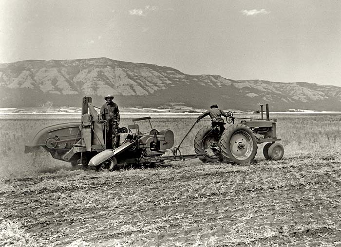
 Harvesting dried peas in the Grande Ronde Valley (3049). Enlarge image.
MISSION, 181.2 m., is headquarters for the Umatilla Indian Agency. At the STATE PHEASANT FARM, 181.9 m., grouse, quail, pheasants, and other game birds are bred for release on the uplands of eastern Oregon.
At 185.7 m. US 30 forms a junction with State 11, the Walla Walla Highway.
Right on State 11 through wheatfields that stretch in a broad panorama up the slopes of the Blue Mountains (R), crossing the UMATILLA (Ind., water rippling over stones) RIVER, to ADAMS, 12.5 m. (1,520 alt, 3178 pop.), named for an early wheat rancher. A school, a church, grain elevators, and dwellings are all that remain of a once thriving settlement.
Right from Adams, on a gravel road 10 m. to THORN HOLLOW (1,450 alt.), a small Indian settlement on the Umatilla Reservation. Left here to GIBBON, 16.1 m. (1,751 alt.), also on the Reservation, which has a school for Indian and white children. At 23.3 m., near the Umatilla River, is BINGHAM SPRINGS, a summer resort centering about the warm sulphur springs (hotel and cabin accommodations).
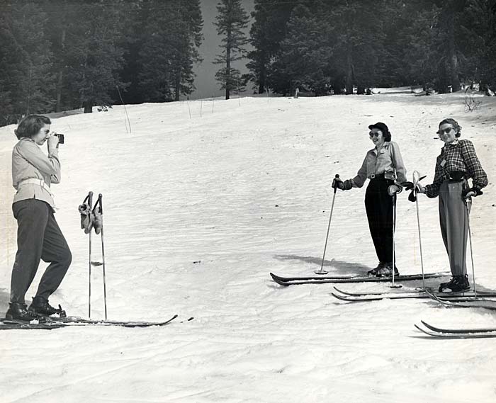
 Skiers in the Tollgate area (4041). Enlarge image.
The old town of ATHENA, 17.7 m. (1,713 alt., 504 pop.), on State 11 by Wild Horse Creek, was a stage station on the road from Walla Walla to Pendleton. It was long the scene of an annual camp meeting with horse racing as an added diversion. A cannery, absorbing the pea yields of former wheatlands, gives the town increasing economic importance.
Before the Civil War WESTON, 21.3 m. (1,686 alt., 384 pop.), did brick making and milling and was the first home of the Eastern Oregon Normal School. Until a fire destroyed all but two business houses in the 1880s. The old SALING HOUSE (private), on Main St., is a two story structure of locally made bricks and has a cupola used as a look out during Indian raids.
The town is the background for Oregon Detour, by Nard Jones, a popular novel.
 Mt. Emily showing panorama of Grande Ronde Valley (3050). Enlarge image.
The summit of WESTON HILL, 30.3 m., commands a splendid panoramic view of the Blue Mountains and the Walla Walla Valley. To the right, is the deep Storm Canyon of the South Fork of the Walla Walla River, with Table Mountain upthrust between it and the North Fork Canyon, on the left. In the foreground, is the deeply etched canyon of the Walla Walla River, with its sun lit orchard valley, bordered by golden terraces of wheat covered foothills.
MILTON, 31.4 m. (1,010 alt., 1,576 pop.) is on the old stage line between Wallula, Wash., and La Grande. The town was settled by a few families who prohibited the sale of alcoholic beverages. In the 1880s the opposition led by the miller, who owned water rights on a nearby stream, moved outside of Milton's corporate limits. Buyers of lots in the new town site received as a bonus free water privileges. Thus was established the town of FREEWATER 32.3 m. (1,010 alt., 732 pop.), which sold its liquor at "Gallon Houses," because Federal permits allowed them to sell liquor only in gallon lots. The two towns, which now overlap, are usually referred to as Milton Freewater. They support a union high school, one of the best in the state.
Milton is the canning and shipping center for a large pea raising area, the altitude, from 1,000 to 3,500 feet, making several harvesting periods. Formerly wheat was the major crop, but from one third to one half of the land was idle under the summer fallow plan. Now, with the rotation of peas and wheat, all of the land is used. Early in the year farmers lease the land not planted with wheat to pea canneries for cultivation. A mechanical drill, powered by a tractor, does the seeding, and while the plants are growing they are sprayed with peeweevil poisons by a machine developed by the Agricultural Department of the Oregon State College. The crop is harvested by tractor drawn swathers that cut the vines close to the ground. An automatic loader lifts the vines and deposits them in dump trucks that carry them to huge stationary viners, where the peas are taken from the pods. They are placed in boxes, which are loaded into water cooled trucks and rushed to the canneries, whose season extends from mid June into August.
 Horseback riding at Bingham Springs (3046). Enlarge image.
After the vines have been stripped, they are stacked and sold to farmers as feed for stock. In 1938 pea vine ensilage ranked second to alfalfa as roughage for cattle in this area, with an average yield of three and a half tons per acre. The vines are also dried and used as hay.
When harvesting comes to an end discs are attached to tractors and the remaining vegetation is turned into the ground. This increases the fertility of the soil and aids in the control of pea pests.
At 36.7 m. is a junction with a gravel road, L. here 12.5 m. to an old HUDSON'S BAY FARM, on which one of the original buildings of the company's settlement still stands. Refugees from Waiilatpu, the Whitman Mission, were said to have been sheltered in this house in 1847.
At 36.7 m. State 11 crosses the Washington Line and at 38.7 m. meets a county road leading northwestward down Walla Walla River valley.
Left on this road 5 m. to the WHITMAN MONUMENT. The old Whitman Mission of Waiilatpu was on the right bank of the Walla Walla River near its confluence with Mill Creek. Near the mission site is a shaft of granite commemorating the Whitman tragedy of Nov. 29, 1847 when thirteen inmates of the mission were slain by Indians.
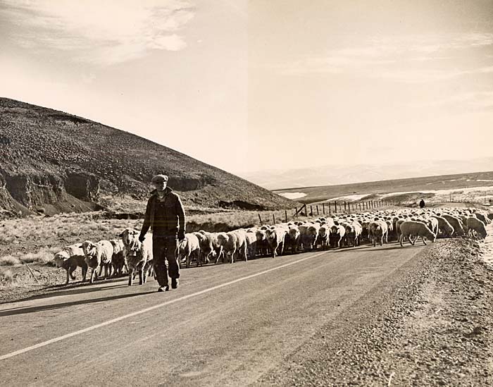
 Moving sheep to lower pasture near Pilot Rock (g304). Enlarge image.
To the left of the grave is the site of the log house built in the fall of 1836 by Dr. Whitman and W. H. Gray, mission blacksmith. A short distance from this cabin stood the main building of the mission a T shaped structure. At the mouth of Mill Creek was the mission mill. All these buildings were destroyed at the time of the Indian uprising.
Dr. Marcus Whitman, a physician belonging to the Presbyterian church, established the mission in 1836, on the site selected the year before by the Reverend Samuel Parker, commissioned by the American Board of Foreign Missions.
Dr. Whitman was prominent in early Oregon history. In 1843 he induced migration into Oregon so as to force it into the hands of the United States. He turned his mission into a sort of relay station, catering to the needs of the emigrants and tending them in illness. The slaying of the mission inmates hastened Congress in declaring Oregon a Territory.