At KERNVILLE, 132.7 m. (26 alt., 150 pop.), at the southern end of Siletz Bay, the highway crosses the Siletz River.
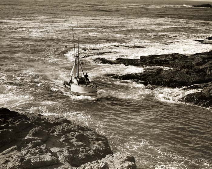
 Depoe Bay fishing boat entering (G269). Enlarge image.
Left from Kernville on State 229 to the FORMER AGENCY OF THE SILETZ INDIAN RESERVATION, 23.8 m. As established in 1855, the Siletz Reservation, which would be home to members of a number of displaced tribes, covered more than one million acres. But the white population of Oregon soon decided there was too much valuable land in the hands of the natives and brought pressure for change. In 1865, President Andrew Johnson signed an executive order that split the reservation in two parts and opened the middle portion, including Yaquina Bay, to white settlement. The remaining reservation land was further reduced a decade later, and in the 1880s and '90s, the Indians were pressured to accept individual land allotments. Most of the unalloted acres, including excellent timber land, went to the government with small compensation.
Though there were more than 2,000 Indians on the reservation in 1856, the numbers had dropped to less than 500 by 1900. Disease, crop failures, and other factors took their toll.
In 1925, the government formally closed the Siletz Agency, but hundreds of Indians continued to live at the reservation site, many on their own land. The agency caring for all Indian affairs west of the Cascades is now at Salem.
John Fleming Wilson's novel, "The Land Claimers" (1911), tells the story of those who rushed into the Siletz lands when they were thrown open to white settlement. Many who came hoping to establish homestead claims and build cabins in this last frontier have left; deserted cabins and clearings now covered with brush are relics of their brief stay.
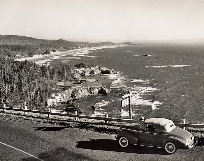
 Otter Crest looking south (1235). Enlarge image.
State 229 continues to a junction with State 26 at 31.9 m.
BOILER BAY, 138.5 m., was so named because the 1910 wreck of the "J. Marhoffer" left a boiler in the north side of the bay. BOILER BAY STATE PARK, 138.7 m., borders a wild sweep of rugged shore traversed by an excellent road.
Just south of the park, on a sloping hillside (L.), are half-covered SHELL HEAPS, some of them an acre or more in extent, remains of Indian meals. The refuse, mixed with sand, provides material for good beach roads.
At DEPOE BAY, 140.1 m., (57 alt., 75 pop.), just east of DEPOE BAY STATE PARK, the shore line is rugged. The resort is on a secluded cove where tall-masted, deep-sea trawlers anchor. The name probably commemorates Charles Depoe, an Indian who received land here under the allotment act. Close to the highway is the SPOUTING HORN (R.), an aperture in the rocks through which the tide rushes upward in a geyser of spray.
The DEPOE BAY AQUARIUM (small fee) contains many forms of marine life, among them red snappers, dogfish, and octopuses. The sea anemone collection is very attractive. A MUSEUM (small fee) contains 500 mounted birds, 3,000 birds' eggs, a fine collection of butterflies, Indian relics, and mounted animals.
Fish races are held annually. In 1936 about 15,000 people placed wagers under the pari-mutuel system. Any deep-sea fish is eligible, and in 1935 the first entry was an octopus. The races are held in a painted trough having a lane 50 feet long for each "contestant." The starting point is painted white, and the finish line is the entrance to a dark recess. The fish, when they are released, seek the hiding hole, flashing to the far end of the lane and shaking a numbered balloon that gives the key to the order of their finish.
 Yaquina Head lighthouse (G547). Enlarge image.
At WHALE COVE, 141.6 m., are many caves cut in sandstone cliffs. ROCKY CREEK STATE PARK (picnicking facilities), 141.9 m., overlooks a rocky shore.
BEN JONES BRIDGE, 142.5 m., dedicated in 1927, a memorial to Benjamin F. Jones, "Father of the Oregon Coast Highway." This high concrete single-arch bridge spans a deep narrow rocky ravine at a point close to the ocean.
OTTER CREST STATE PARK, 144.2 m. (454 alt.), on a high promontory, overlooks one of the most impressive seascapes between Astoria and Newport. Iron Mountain, a cone-shaped peak, is directly south.
The name of the park commemorates the sea otter, once important in the Pacific Coast fur trade. Indians made robes of the skins, and whites found their value for trade in overseas markets. The story of the sea otter's place in Oregon history is told in "The Quest of the Sea Otter" by Sabra Conner.
At 145.5 m. is the junction with an improved road.
Right here to DEVILS PUNCHBOWL STATE PARK, (tables and fireplaces), 0.5 m. Immediately below a sandstone bluff is the DEVILS PUNCHBOWL, where incoming tidal waters rush through two openings in a deep, round cauldron to boil up, then recede. Offshore is OTTER ROCK, a sea-bird rookery.
South of the entrance to the park, are the vestiges of railroad trestles used to transport spruce cut for airplane manufacture during the World War.
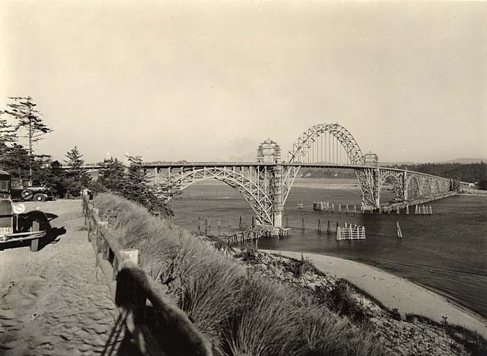
 Yaquina Bay Bridge from park (141). Enlarge image.
OCEAN PARK, 146.7 m. (25 pop.), facing rocky reefs, overlooks a rookery offshore where gulls, cormorants, and other waterfowl nest.
AGATE BEACH, 151.3 m. (124 alt., 150 pop.), is noted for an abundance of agates. The Oregon coast between Tillamook Bay and Coos Bay has exceptionally fine and extensive beach deposits of jasper, water agates, moss agates, "Oregon jade," and fossilized wood.
Right from Agate Beach to YAQUINA HEAD LIGHTHOUSE, 1 m., which went into operation in 1873. It was to have been placed on Otter Crest, but construction materials were delivered here by mistake. [Editor's note: the last sentence is incorrect.]
At YAQUINA HEAD, the ocean dashes at the base of the cliffs and screaming sea birds dart and circle above the rocks. South of the head, is an extensive MARINE GARDEN, that can be visited at low tide. Starfish and sea anemones abound here.
NEWPORT, 154 m. (134 alt., 1,530 pop.), (hotels, tourist camps, natatorium; boats for clamming, crabbing, and deep-sea fishing), spreads across a blunt ridged peninsula between the ocean and Yaquina Bay. The Ocean House, built in 1866, and the Abbey House, opened in 1871, began to draw visitors. For early settlers in the area not involved in tourism, limited choices for livelihood included farming and fishing. The town received a boost in the 1880s when the old Oregon Pacific Railroad connected the area to the Willamette Valley and steamships carried freight and passengers to San Francisco.
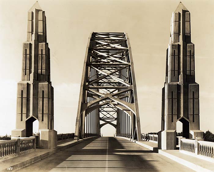
 Yaquina Bay Bridge deck view-north end and middle arch (151). Enlarge image.
Newport is now primarily a resort with a somewhat Victorian appearance in the older areas. Shellfishing gives it some commercial importance. Crabs, clams, and oysters (the latter artificially planted to renew supply) are shipped inland. Oystering is done in flat-bottomed boats with the aid of long-handled tongs.
The view of the bay at sunset, when the fishing fleet rides at anchor, is particularly attractive. This bay is also the anchorage for the deep-sea fishing boats carrying visitors across the bar to fish and watch for porpoises, sea lions, and whales occasionally seen offshore.
John Fleming Wilson (1877-1922), author of numerous books, lived here for about three years after his marriage in 1907. Mariner, school teacher, and newspaper reporter, he was able to leave $90,000 earned by writing stories and novels, some of which were based on material gathered in the Yaquina Bay district.
At Newport is a site said to be the location of a blockhouse established in 1856 by Lieut. Phil Sheridan, who would later gain fame as a Civil War general. In his memoirs, Sheridan told a strange story about selecting a site where he found an Indian graveyard comprised of "probably from forty to fifty canoes in a fair state of preservation." In a meeting with Indians to resolve the situation, "It was agreed that on the following day at 12 o'clock, when the tide was going out, I should take my men and place the canoes in the bay, and let them float out on the tide across the ocean to the happy hunting-grounds."
Newport is at the junction with State 26.
Near the north end of NYE BEACH, which is the ocean side of Newport, is JUMP-OFF JOE, the rock from which, legend says, the usual Indian maiden and her lover flung themselves. The monolith is the remains of a rocky cape that formerly extended from the mainland. On the beach, English coins have been found dated 1788, the year Gray and Meares first explored the coast. Like other maritime towns. Newport has a HAUNTED LIGHTHOUSE, which stands on the narrow promontory north of the entrance to Yaquina Bay.