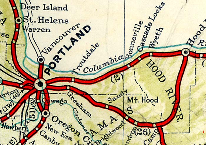
 Section map (enlarge image)
EAGLE CREEK PARK (L), 148.7 m., one of Oregon's finest recreational areas and picnic grounds, was constructed and is maintained by the U.S. Forest Service. On the banks of plunging Eagle Creek are rustic kitchens, tables and extensive parking facilities.
Left here on the Eagle Creek Trail, that winds up the mountain side to WAHTUM LAKE, 13.5 m. Construction of the trail presented many difficulties; parts of it are cut through solid rock, and in one place it passes behind a waterfall. Along the trail are GHOST FALLS and the DEVIL'S PUNCH BOWL The latter, a fresh water cauldron hemmed in by pillars of basalt, abounds with steelhead trout.
Right across Eagle Creek from Eagle Creek Campground on the WAUNA POINT TRAIL, which leads 5.5 m. through Eagle Creek and Columbia Gorge canyons to WAUNA POINT (2,500 alt.).
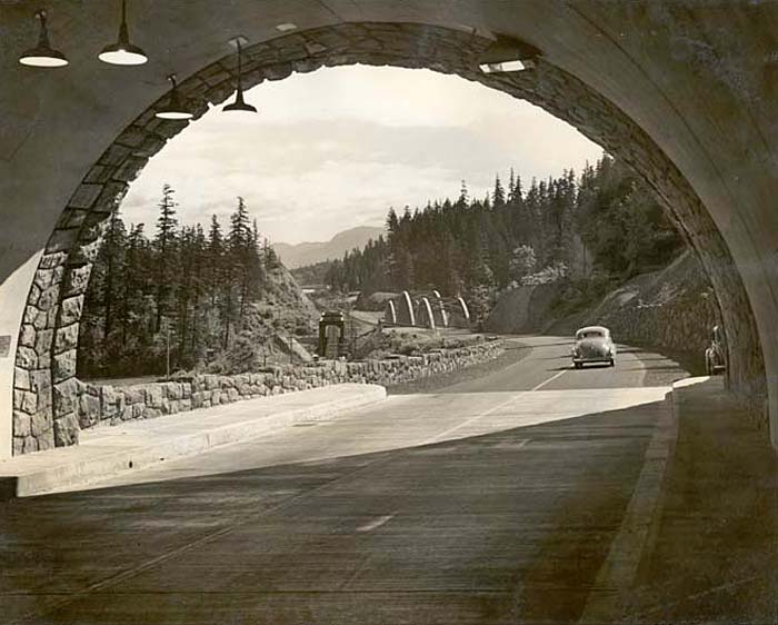 Tooth Rock Tunnel and Eagle Creek Bridge on Highway 30 (827). Enlarge image.
BONNEVILLE, 150 m. (50 alt., 800 pop.), is at Bonneville Dam, begun by the Federal Government in 1933 and finished in 1938. The dam, designed by U.S. Army engineers, raised the level of water to a point four miles above The Dalles. Many of the river's beauty spots and historic sites were submerged by this impounding of water. The Cascades and much of the shore line disappeared beneath the rising waters of the great reservoir.
The dam spans the Columbia River from Oregon to Washington, a distance of 1,100 feet. Bradford Island, an old Indian burial ground separating the river's two channels, is at the center of the mammoth barrier. There is a single lift lock, 75 feet wide and 500 feet long, near the Oregon shore; a power plant with two completed units, each of 43,000 kilowatts capacity, and with foundation for four additional units; a gate control spillway dam creating a head of 67 feet at low water; and fishways designed to permit salmon to ascend the Columbia to their spawning grounds on its upper tributaries. The slack water lake formed above the dam creates a 30-foot channel between Bonneville and The Dalles, a distance of 44 miles. With the deepening of the Columbia between Vancouver, Washington and the dam, to a depth of 27 feet, the river will be navigable to sea going craft for 176 miles inland. The final cost of the project, including ten hydroelectric units with a capacity of more than a half million horsepower, will be more than $70,000,000.
 Bonneville Dam (696). Enlarge image.
Bonneville was named for Captain Benjamin de Bonneville, whose exploits were set forth in The Adventures of Captain Bonneville by Washington Irving.
At MOFFET CREEK, 151.4 m., the highway crosses a large flat-arch cement bridge. The span, 170 feet long, is 70 feet above the stream.
The JOHN B. YEON STATE PARK, 152 m., was named in honor of an early highway builder.
At the eastern end of the McCord Creek Bridge, 152.6 m., is a petrified stump believed to have matured long before the Cascade Range was thrust up.
Left from the eastern end of the bridge on a trail along the creek to ELOWAH FALLS.
At 153.2 m. BEACON ROCK, across the Columbia (R), is seen. Alexander Ross, the fur trader, called it Inshoach Castle. A landmark for river voyagers for more than a hundred years, it is now surmounted by a beacon to guide airplanes. A stirring chapter of Genevieve: A Tale of Oregon relates dramatic events that took place on its summit. A foot trail has been carved in its side from base to crest.
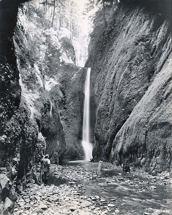 Oneonta Falls (597). Enlarge image.
HORSETAIL FALLS, 156.6 m., forming the design that gives it name, shoot downward across the face of the sheer rock wall into an excellent fishing pool. Spray from the pool continually drifts across the highway. East of the falls towers ST. PETERS DOME, a 2,000-foot basalt pinnacle.
ONEONTA GORGE, 156.9 m., is a deep, narrow cleft in the basalt bluff through which flows a foaming creek. Fossilized trees caught by a lava flow, are entombed in its perpendicular walls.
Left from the highway on a trail to ONEONTA FALLS, 800 ft., hidden in the depths of the gorge. The water, falling into the narrow ravine, stirs the air into strong currents giving it a delightful coolness even when temperatures are high.
MULTNOMAH FALLS, 159 m., inspired Samuel Lancaster, builder of the Columbia River Highway, to write: "There are higher waterfalls and falls of greater volume, but there are none more beautiful than Multnomah," a sentiment approved by many observers. The source is near the summit of Larch Mountain 4,000 feet above the highway. After a series of cascades the waters drop 680 feet into a tree fringed basin.
Left from Multnomah Falls on a foot trail, across a bridge above the short stretch of creek between the upper and lower falls, to LARCH MOUNTAIN, 6.5 m., (4,095 alt.).
 Shepperds Dell on the Columbia River Highway (1889). Enlarge image.
WAHKEENA (Ind. most beautiful) FALLS, 159.6 m., named for the daughter of a Yakima Indian chief, are considered by some the most beautiful of the many falls in the gorge. There is no sheer drop, but the waters hurl themselves in a series of fantastic cascades down the steep declivity. Wahkeena Creek has its source in Wahkeena Springs only a mile and a half above the cliff over which waters plunge.
MIST FALLS, 159.8 m., where the water drops from a 1,200 foot escarpment were mentioned by Lewis and Clark: "Down from these heights frequently descend the most beautiful cascades, one of which [now Multnomah Falls] throws itself over a perpendicular rock ... while other smaller streams precipitate themselves from a still greater elevation, and evaporating in mist, again collect and form a second cascade before they reach the bottom of the rocks."
COOPEY FALLS, 161.9 m., according to Indian legend is at the site of a battle of giants.
BRIDAL VEIL, 162.7 m. (40 alt., 204 pop.), is a lumber mill town in a small valley below the highway. Formerly Bridal Veil Falls was noted for its beauty but the waters now are confined in a lumber-flume.
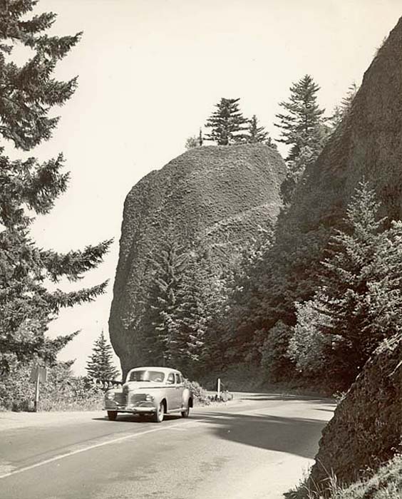 Columbia River Highway at Bishops Cap (2490). Enlarge image.
Two sharp rocks between which pass the tracks of the Union Pacific and known as the PILLARS OF HERCULES or SPEELYEI'S CHILDREN, the latter name commemorating the feats of the Indian coyote god, rise (R) beyond FOREST HILL.
In the shadowy grotto of SHEPPERD'S DELL, 163.7 m., a sparkling waterfall leaps from a cliff. A white concrete arch bridges a chasm 150 feet wide and 140 feet deep. Near the bridge the highway curves around a domed rock known as BISHOP'S CAP or MUSHROOM ROCK.
LATOURELLE FALLS, 164.9 m., take a sheer drop of 224 feet into a pool at the base of an overhanging cliff. LATOURELLE BRIDGE was so placed as to give the best view of the falling waters.
The GUY W. TALBOT PARK, 165.1 m., is a 125 acre wooded tract overlooking the Columbia.
Winding along the forested mountainside the highway reaches CROWN POINT, 167.3 m., 725 feet above the river on an overhanging rocky promontory. The highway makes a wide curve, in the center of which is the VISTA HOUSE. This impressive stone structure, a modern adaptation of the English Tudor style of architecture, modified to conform to the character and topography of the landscape, was built at a cost of $100,000. The foundation of Vista House is laid in Italian style dry masonry, no mortar having been used. Men were imported from Italy to work here and elsewhere along the highway. The windswept height, once known as THOR'S CROWN, commands a view of the river east and west for many miles.
Inside the Vista House is a bronze tablet recording the explorations of Lieut. William Broughton of Vancouver's expedition, who came up the Columbia River in 1792.
The SAMUEL HILL MONUMENT, 168.5 m., is a 50 ton granite boulder dedicated to the man who was chiefly responsible for building the Columbia River Highway.
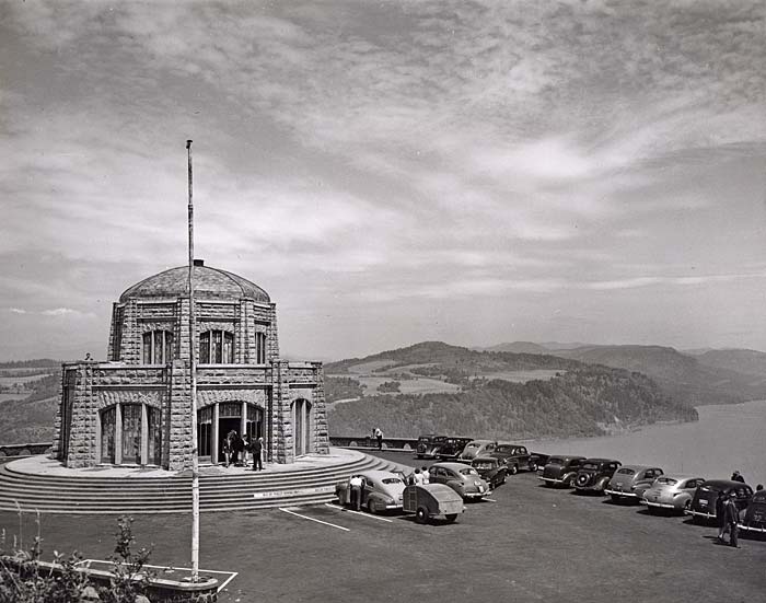 Vista House overlooking the Columbia Gorge (692). Enlarge image.
CORBETT, 169.9 m. (665 alt., 90 pop.), set in rolling hills, is at the eastern end of a cultivated area. The road cuts between the cliffs and the waters at the SANDY RIVER, 174.5 m. This stream, flowing from the glaciers on the south slope of Mt. Hood, was discovered by Lieut. William Broughton on Oct. 30, 1792, and named Barings River for an English family. The bluffs near the river mouth now bear the name of the discoverer. Lewis and Clark passed this point on Nov. 3, 1805, and in their Journals record the immense quantities of sand thrown out. They wrote: "We reached the mouth of a river on the left, which seemed to lose its waters in a sandbar opposite, the stream itself being only a few inches in depth. But on attempting to wade across we discovered that the bed was a very bad quicksand, too deep to be passed on foot ... Its character resembles very much that of the river Platte. It drives its quicksand over the low grounds with great impetuosity and ... has formed a large sandbar or island, three miles long and a mile and a half wide, which divides the waters of the Quicksand river into two channels."
The river is noted locally for its annual run of smelt (eulachan), which ascend in millions each spring to spawn. When they appear word goes out that "the smelt are running Sandy." Cars soon crowd highways, while hundreds of people snare the fish with sieves, nets, buckets, sacks or birdcages. (Special license required, 5c)
TROUTDALE, 177.7 m. (50 alt., 227 pop.), is a trade center for a fruit and vegetable producing area specializing in celery. Between truck gardens and dairy farms, US 30 crosses the bottom lands of the widening Columbia Valley to FAIRVIEW, 180.3 m. (114 alt., 266 pop.), and past orchards, bulb farms, and suburban homes to PARKROSE 185.2 m.
PORTLAND, 192.7 m. (32 alt., 301,815 pop.).
Points of interest: Skidmore Fountain, Oregon Historical Society Museum, Art Museum, Portland Public Market, Sanctuary of our Sorrowful Mother.
Portland is at junction with US 99, State 8, State 50, US 99W.