This section of the route, one of the most spectacular in the United States, is never long out of sight of the sea. It crosses inlets and marshes on beautiful modern bridges; passes through villages reeking with the smell of salmon oil and decaying flotsam softened by the tantalizing odor of brine-soaked pilings; and proceeds over sand reaches where many bits of bone and shell from the refuse pits of an earlier civilization are exposed by the wind.
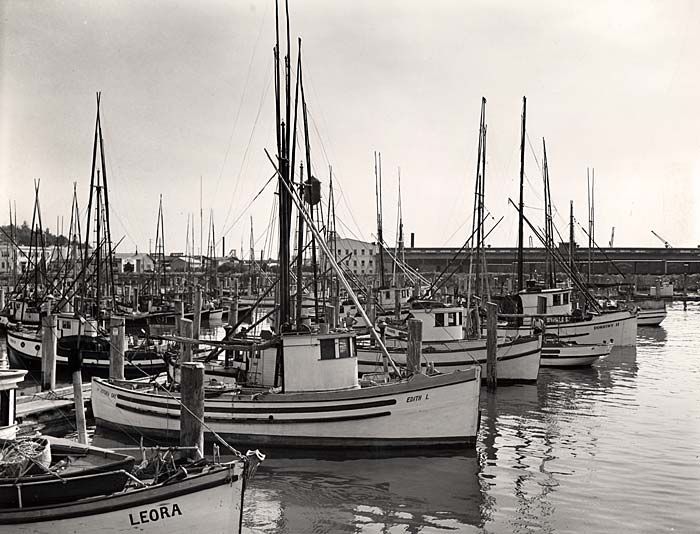 Fishing fleet anchored in Astoria (994). Enlarge image.
U.S. 101 crosses the Washington Line, in the middle of the Columbia River at a point 87 miles south of Aberdeen, Wash. Travelers cross the river on the Point Ellice-Astoria ferry. (Car and driver $1; passengers $.25 each).
At 0 m., is the junction with U.S. 30.
Here U.S. 101 swings R. then L. around SMITH POINT, 2 m., at the entrance to Youngs Bay, an arm of the Columbia. In the water lie the decaying hulls of half-completed merchant ships, abandoned at the close of the World War. The headland, on the opposite side of Youngs Bay, about three miles away, is POINT ADAMS, near which in 1792 Lieut. William Broughton, an English officer, anchored the "Chatham" and set out to explore, using a cutter and launch. He entered a bay and a river, naming the river in honor of Sir George Young of the royal navy. The bay, in turn, took its name from the river.
U.S. 101 crosses Youngs River, 3.4 m., and at 4.8 m. meets Miles Crossing Road.
Left here up Youngs River to (L.) the UNITED STATES NAVAL RADIO STATION, 0.5 m., which broadcasts weather observations and storm warnings for the Oregon and Washington coast and reports conditions on the bar at the mouth of the Columbia River. At 10 m. the road loops around Youngs River Falls.
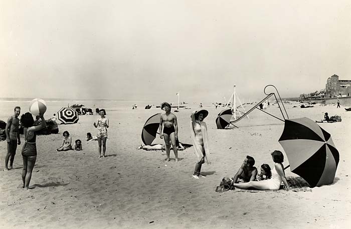 Seaside beach scene (616). Enlarge image.
At
13 m. is the junction with a dirt road; R. for
12 m. to SADDLE MOUNTAIN STATE PARK. An Indian legend told of an old giantess who found Thunderbird's eggs at the top of the mountain. When she broke the eggs and threw them down the mountainside, each became an Indian. On the mountain (3,266 alt.) are trails, shelters, and picnic grounds. Much hunting for deer (and occasionally for elk) and fishing for trout is done in this area.
U.S. 101 crosses the Lewis and Clark River, 5.7 m., named for the leaders of the overland expedition sent by President Jefferson in 1804 to find a route "to the Western Ocean." William Clark and Meriwether Lewis led the expedition across the Rocky Mountains and down the Columbia River, reaching this coast late in 1805. Sacajawea, a Shoshone Indian, and her husband, a French-Canadian, acted as interpreters for the party.
At 6.5 m. is the junction with a gravel road.
Left here to the SITE OF FORT CLATSOP, 1.5 m., the winter encampment of the Lewis and Clark party in 1805-06.
Now overgrown with evergreens, the site is designated by a flagpole and is marked by a plaque. On Dec. 7, 1805, Clark recorded:
"after brackfast I delayed about half an hour before York Came up, and then proceeded around this Bay which I have taken the liberty of calling Meriwethers Bay the Cristian name of Capt. Lewis who no doubt was the 1st white man who ever Surveyed this Bay...." Clark was in error on this.
Working against time and weather, men of the party felled trees and completed their shelters sufficiently to move in before Christmas.
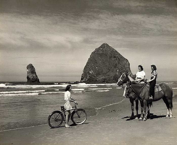 Cannon Beach (927). Enlarge image.
The first American Christmas in the Northwest was a meager affair. Clark wrote: "at day light this morning we we[re] awoke by the discharge of the fire arm of all our party & a Selute, Shoute and a Song which the whole party joined in under our windows, after which they retired to their rooms were Chearfull all the morning-- after brackfast we divided our Tobacco which amounted to 12 carrots one half of which we gave to the men of the party who used tobacco, and to those who doe not use it we make a present of a handkerchief, The Indians leave us in the evening all the party Snugly fixed in their huts-- I recved a presnt of Capt L. of a fleece hosrie Shirt Draws and Socks--, a pr. mockersons of Whitehouse a Small Indian basket of Gutherich, two Dozen white weazils tails of the Indian woman, & Some black root of the Indians before their departure-- ... The day proved Showerey wet and disagreeable ... our Dinner concisted of pore Elk, So much Spoiled that we eate it thro' mear necessity, Some Spoiled pounded fish and a fiew roots." They were without salt to season even that.
On the 26th Clark wrote: "we dry our wet articles and have the blankets fleed, The flees are So troublesom that I have Slept but little for 2 nights past and we have regularly to kill them out of our blankets every day for Several past--" The fleas, Clark explained in a later journal entry, were contributed by the Indians during their visits. On the 27th he added, "Musquetors troublesom."
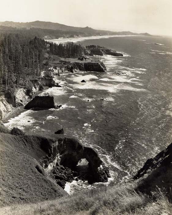 Looking south from Otter Crest State Park (406). Enlarge image.
On December 30 Clark wrote: "...at Sun set we let the nativs know that our Custom will be in future, to Shut the gates at Sun Set at which time all Indians must go out of the fort and not return into it untill next morning after Sunrise at which time the gates will be opened, those of the War ci a cum Nation who are very forward left the houses with reluctianc." In view of the Indians' conceptions of property rights, this seems to have been an expedient ruling.
On December 31 Clark noted: "With the party of Clat Sops who visited us last was a man of much lighter Coloured than the nativs are generaly, he was freckled with long duskey red hair, about 25 years of age, and must Certainly be half white at least, this man appeared to understand more of the English language than the others of his party, but did not Speak a word of English, he possessed all the habits of the indians." In "Adventures on the Columbia" (1832), Ross Cox also described such a man and said the Indians alleged he was the son of an English sailor who had deserted from a trading vessel. He was called "Jack Ramsay" because that name was tattooed on his arm. "Poor Jack was fond of his father's countrymen," Cox wrote, "and had the decency to wear trousers whenever he came to the fort [Astoria]. We therefore made a collection of old clothes for his use, sufficient to last him for many years."
By March the leaders of the party believed the mountain snows would be melting, and the return to the East could be made. On March 23 Clark reported: "...we loaded our Canoes & at 1 P.M. left Fort Clatsop on our homeward bound journey. at this place we had wintered and remained from the 7th of Decr. 1805 to this day and have lived as well as we had any right to expect, and we can Say that we were never one day without 3 meals of Some kind a day either pore Elk meat or roots ..."
By the junction with the Fort Clatsop Road is the ASTORIA MUNICIPAL AIRPORT, 6.6 m., terminus of the Portland-Astoria airway, opened in 1936.
At 7.9 m. is the junction with a paved road.
Right here to WARRENTON, 2 m. (8 alt., 683 pop.), one of several places where the chief business is razor-clam canning. The road continues through the undulating dunes, marshes, and fertile lowlands--a strip about 4 miles wide and 24 miles long--of Clatsop Plains, composed of sediment deposited by the Columbia River and now worn into ridges by wind and tide.
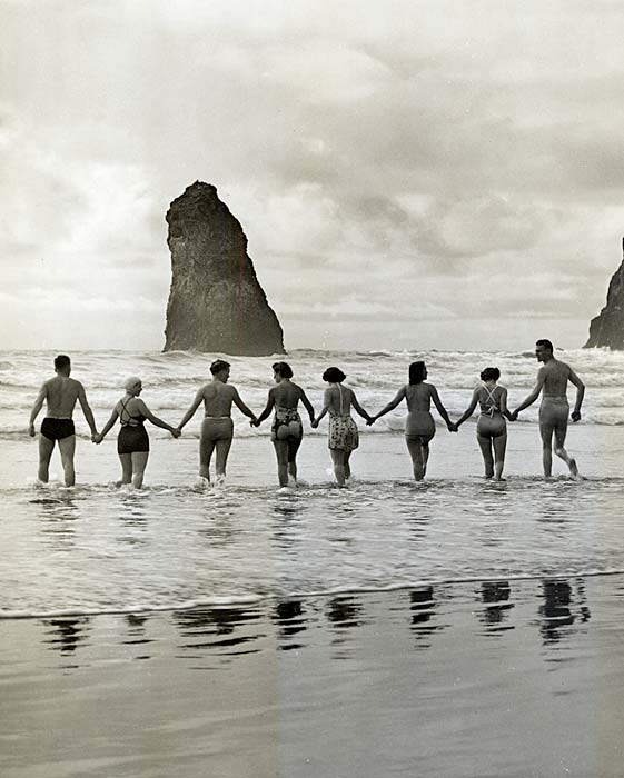 Bathers at Cannon Beach (G537). Enlarge image.
A Coast Guard station is at POINT ADAMS, 5 m., named for Vice President John Adams in 1792 by Capt. Robert Gray. In 1775 Capt. Bruno Heceta observed the point. He named it Cabo Frondoso, which means "Leafy Cape." Though Heceta had reached the Columbia River, he did not realize the fact.
FORT STEVENS, 6 m., the only coastal fortification in Oregon, has a small garrison. Each summer the encampment of the coast artillery of the Oregon National Guard is held here.
At 11.1 m. is the junction with a gravel road.
Right here to CAMP CLATSOP, 0.5 m., used in summer by the infantry and field artillery units of the Oregon National Guard. Maneuvers are usually held in July.
The road turns south, passing the GRAY MEMORIAL CHAPEL, (R.) 11.2 m., on the site of an early Presbyterian church. Worshippers belonged to a congregation organized in 1846 by the Rev. Lewis Thompson and other early settlers. W.H. Gray, one of the founders, wrote the first local history of Oregon, published in 1869. The chapel erected by his daughter is a square brick structure with a long and somewhat lower brick wing. The roof of the main unit rises to a square bell tower topped by a steeple. The pedimented entrance portico has walled sides and a recessed entrance between tall columns.
DELLMOOR, 15.7 m., was named for or by J.S. Dellinger, who established a cranberry bog here in 1912. In spring this section of the route is banked with Scotch broom. Sometimes 15 feet high and bearing long sprays of golden pea-like flowers, it is constantly spreading farther south along the coast. An annual May Festival celebrates the seasonal bloom.
At 18 m. is the junction with a paved road.
Right here to GEARHART, 1 m. (16 alt., 125 pop.), a beach resort with an excellent 18-hole golf course on which the Oregon golf championship matches are played in late summer. Many conventions are held in the town.