
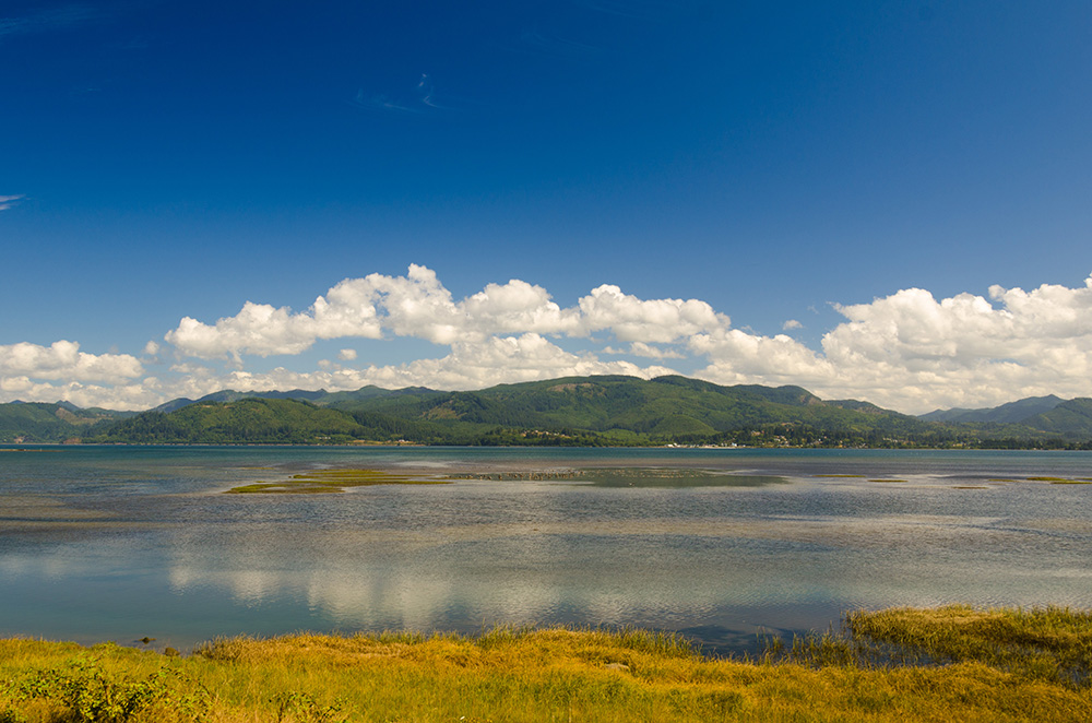
 Tillamook Bay from Bayocean Spit. (Oregon State Archives, 2012)
Get a high resolution copy of this image from the Oregon Scenic Images Collection.
The town that fell into the sea was planned in 1906 as a resort community on Tillamook Spit. It was a sandy strip of land on the ocean side of Tillamook Bay. Its post office was established in 1909, and by 1914 the resort town had a population of over 2,000 people.
Bayocean’s named derived from views of Tillamook Bay and the ocean on either side. From the outset it was intended as the “Atlantic City of the West.” The town had a dance hall, hotel with an orchestra, 1,000-seat movie theater, shooting range, bowling alley, tennis courts, a rail system, and four miles of paved streets. Bayocean’s crown jewel was a heated natatorium with wave generators and a bandstand for live music while guests swam. Even though Bayocean’s economy was based on tourism, it was far from a company town. There were several other businesses, including a cannery, tin shop, machine shop, and a Texaco gas station.
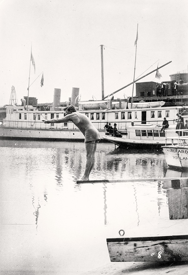 World champion swimmer Richmond Cavill prepares to dive at Bayocean in the early 1900s. (Courtesy of Oregon Historical Society) Enlarge Image
At a time when many other towns did not have high tech infrastructure like electricity or paved roads, Bayocean boasted a water system, telephone system, and a diesel-driven power plant. Infrastructure and construction were aided by a small railroad called “The Dinky.” This tiny train had portable tracks that could be moved according to the building destination. The Dinky ran from a pier standing in the sea, as Bayocean was not connected by road or rail to the rest of the country until the 1920s.
Most residents and tourists arrived via T. B. Potter’s steamship, the S.S. Bayocean. She was the largest yacht on the coast, and took three days to make the trip from Portland. The final leg of the journey entered the unprotected mouth of Tillamook Bay and proved a rough and often frightening experience. Eventually Bayocean’s residents asked the Army Corps of Engineers for a protective jetty to reduce the waves. The Army studied the location and suggested that two jetties be built, one on each side of the bay’s mouth, at an estimated cost of $2.2 million. The Army Corps would secure funding for half the cost, but the other half was required to come from local residents. With the multimillion-dollar price considered unaffordable, Bayocean's residents only built a single jetty for a little over $800,000.
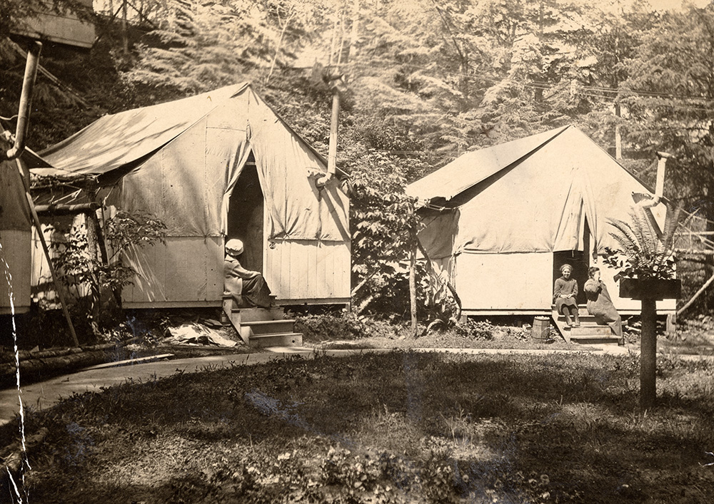 Bayocean Tent City in the early 1900s. (Courtesy of Oregon Historical Society) Enlarge Image
The single jetty worked for a time, and made for a much smoother journey into the bay. An issue arose when the one-sided change to the coastline began a process of erosion that ate away Bayocean’s beaches. They narrowed for a time, before the sea completely overtook them. It was the beginning of the end.
In 1932, waves from a massive storm finally crossed the beach and destroyed the natatorium. The spit itself was further damaged by several winter storms, and by 1952 what was left of Bayocean had become an island. Bayocean’s post office closed in 1953. What little remained of the town was demolished during the reclamation and dike-building project of 1956.
Saving the town now meant saving the buildings from the sea. Several of the original buildings from Bayocean were moved to Cape Meares, including the school house, which is now a community center. In 1960, Bayocean’s last house was washed away, and in 1971 the last remaining building, a garage, finally fell into the ocean.
A second jetty was built in the 1970s and sand began to reaccumulate on the spit. The site is now the location of Bayocean Peninsula County Park and virtually all traces of the town are gone beneath the sand and surf. All that remains is a commemorative sign at the south end of the park.
More Bayocean Photos
People stand along a Bungalow City walkway at Bayocean in the early 1900s. (Courtesy of Oregon Historical Society) Enlarge Image
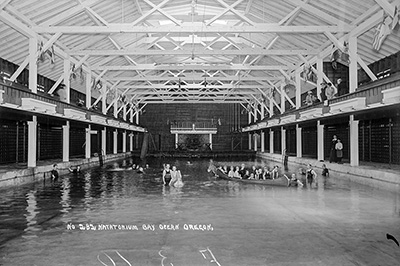
The natatorium at Bayocean circa 1915. (Courtesy of Oregon Historical Society) Enlarge Image
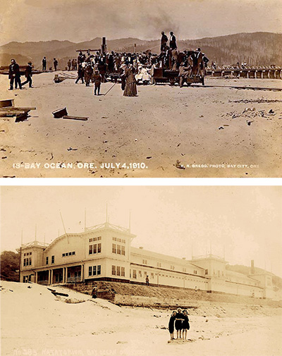
Top: A narrow gauge, private railroad on the beach at Bayocean carried building supplies such as concrete and lumber for the construction of various buildings at the real estate development. The portable tracks could be moved depending on need. Shown above is a group of potential buyers or investors in 1910.
Bottom: The Bayocean Natatorium was built on the edge of the sand in 1914. It was part of a larger, ill-fated resort community that the town founder hoped would become the “Atlantic City of the West.” (Courtesy PDXHistory.com) Enlarge Images